Google Maps Road Symbols - What Do They Mean?
![]() 3 min. read
3 min. read
![]() Updated on
Updated on
Share this article

Improve this guide
Read our disclosure page to find out how can you help MSPoweruser sustain the editorial team Read more
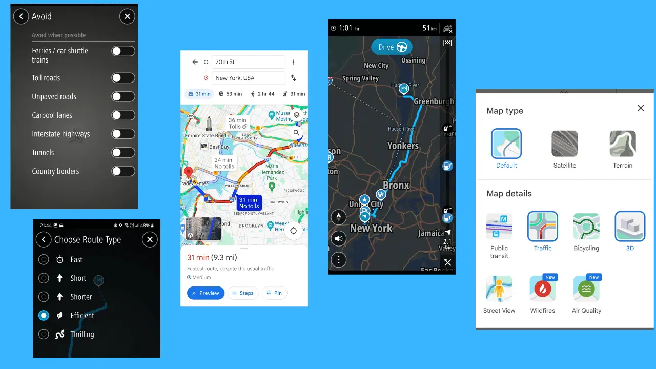
Google Maps road symbols provide critical information about the type of road, traffic conditions, and other geographical details that can help users navigate more effectively.
Let’s have a look at the most important symbols and their meanings.
Bus Icon
A bus icon along your route shows that there’s a bus station. It resembles a white bus front face inside a blue square.
Arrows on the Road
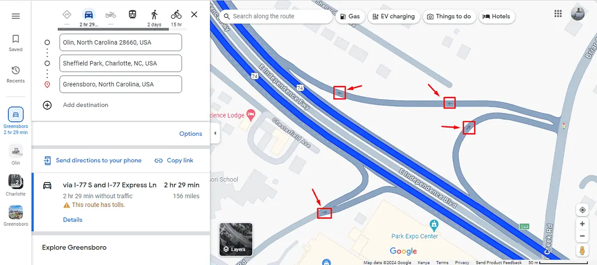
These symbols show the direction of traffic on every road.
A White H Symbol
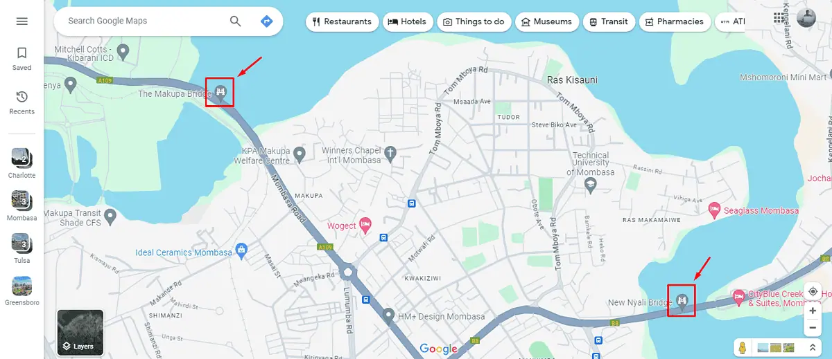
If you see a white H symbol ahead of your route that means you’re approaching a bridge.
A Big White Circle

A big white circle represents a roundabout. It normally appears where two or more roads intersect.
Rail Icon
This icon shows a light rail station. It resembles a white train inside a blue squire.
Red, Yellow, and Green Icon
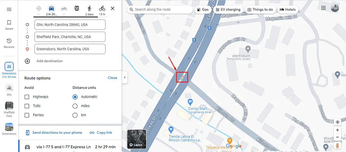
You’ll mostly see this symbol where two or more roads have intersected or on a roundabout. It’s a sign of traffic lights with different colors and meanings:
- Red – Stop.
- Yellow – Wait.
- Green – Go.
Red Car Icon
This icon is used to indicate an accident on the road. It helps drivers anticipate possible delays and consider alternate routes if available.
A Person Holding a Wheelbarrow
A person holding a wheelbarrow sign indicates ongoing construction or roadwork. This icon is particularly useful for identifying areas where delays might occur due to construction activities, or lanes might be closed.
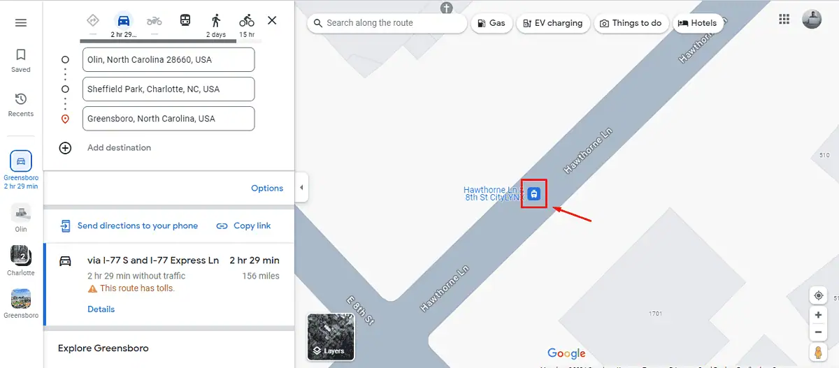
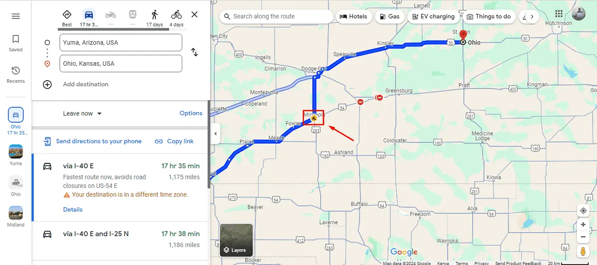
Red Circle with a Minus Sign
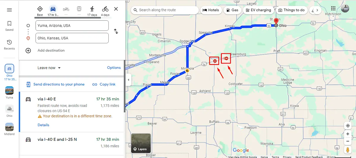
This icon represents road closures. It informs you that a particular section of the road isn’t passable, which is crucial for rerouting before you reach the closure.
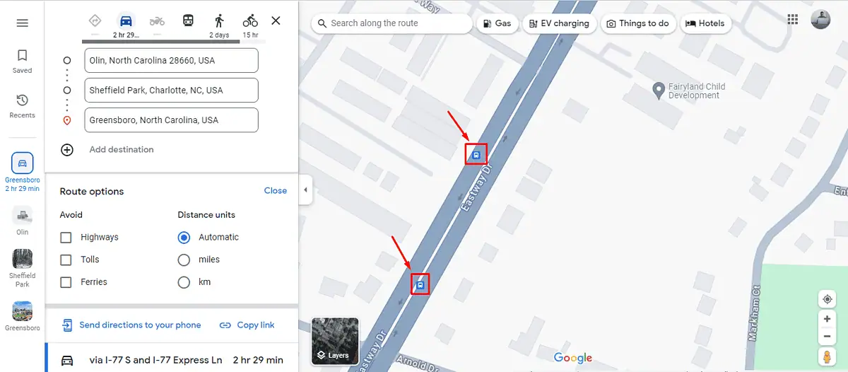
Traffic Conditions
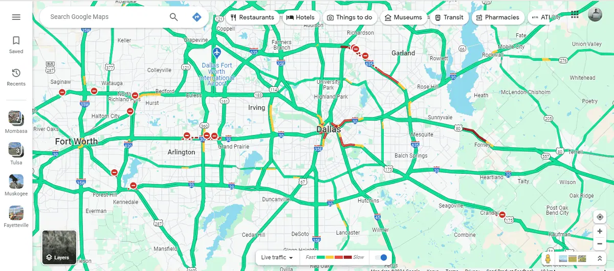
Google Maps uses colors to indicate traffic conditions in real-time if you select traffic view on the layers button. It shows green, yellow, red, and dark red. Here are the interpretations:
- Green: Clear traffic
- Yellow: Moderate traffic
- Red: Heavy traffic
- Dark Red: Traffic is heavily congested or stopped.
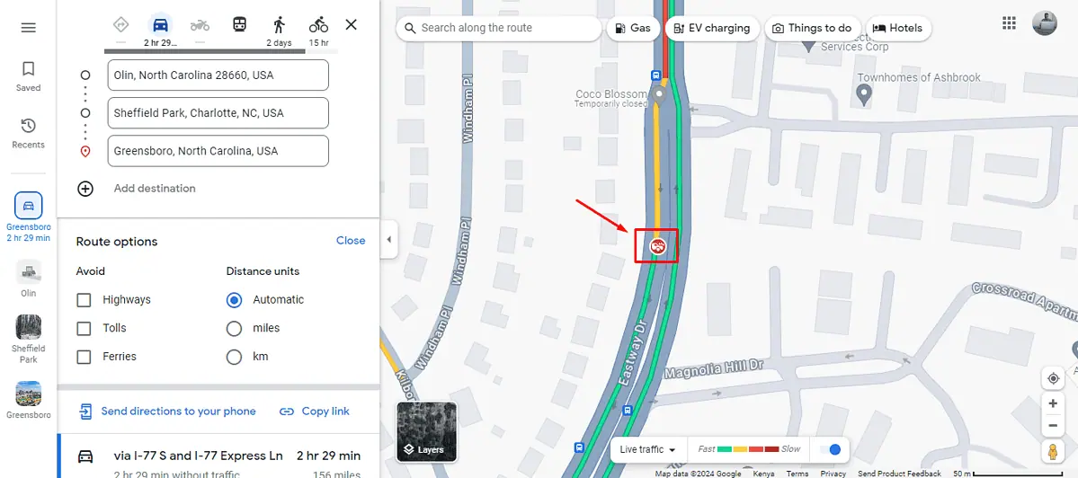
A Yellow Circle With a Black Mesh
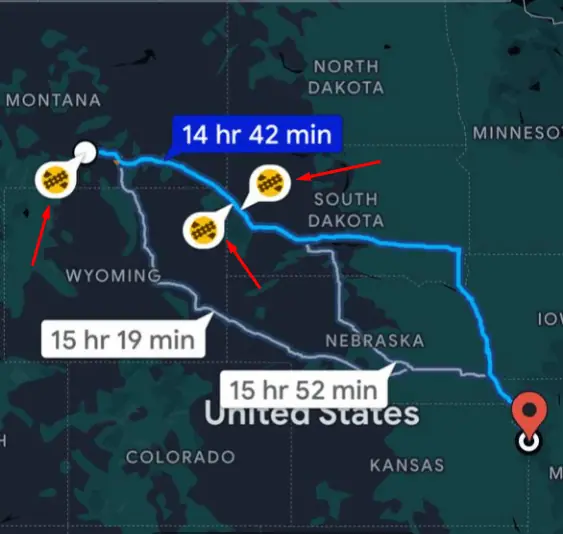
You might fail to spot some symbols in the browser version. However, they are available on mobile apps. A yellow circle with a black mesh represents a railway line intersecting the road.
A Vehicle with an Exclamation Mark
I could also see this symbol on the mobile app. It means that the car has a failed engine or any other mechanical damage.
A Speed Gun Inside a Blue Circle
This symbol means that people or someone reported a speed gun in the location.
Google Maps road symbols and icons are essential tools for anyone looking to navigate efficiently. By understanding what they represent, you can anticipate and react to a variety of road conditions for a smoother and safer journey.