Chinese bridge at Pangong Tso nears completion, show satellite images
China has been strengthening infrastructure and connectivity near the border regions even during the winters. Similar incidents of the construction of roads and bridges have also been reported near Galwan.
")

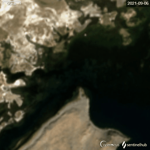
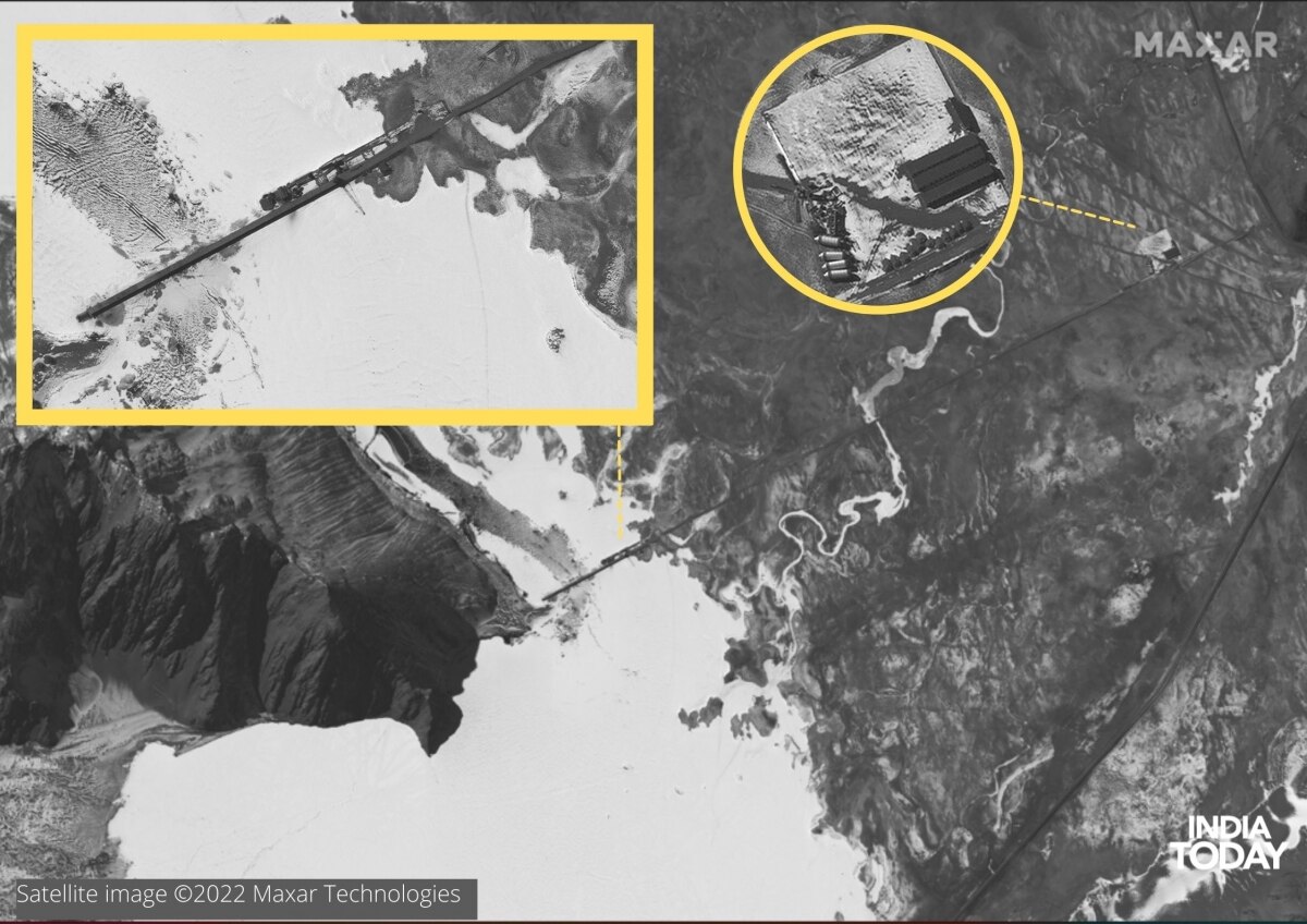
New satellite images of an under-construction bridge connecting the north and south banks of the Pangong Tso lake suggest that the speed of construction peaked during the winter. The bridge is being constructed right near India’s claim line that has remained under Chinese control for decades.
ALSO READ | Chinese construction of bridge on Pangong Lake on for over two months, extremely close to LAC
Imagery provided by space firm Maxar Technologies, analysed with pictures from the European Space Agency, suggests that though the construction work began in September last year from the northern shores of the lake, its completion is only a few metres away from the southern bank. China has been strengthening infrastructure and connectivity near the border regions even during the winters. Similar incidents of the construction of roads and bridges have also been reported near Galwan.
ALSO READ | 60,000 Chinese troops deployed near Indian border, Indian Army also enhances troops in Ladakh
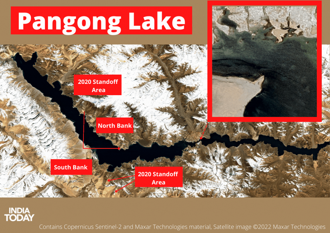
The move is being seen as Chinese attempt to negate a repeat of the August 2020-like operation when Indian armed forces surprised the PLA ground forces by gaining control of critical positions on the Kailash heights. The standoff on the southern end of the bank witnessed Indian and Chinese forces standing less than 200 metres from each other. The standoff in the Pangong area was resolved following a mutual agreement to withdraw from the forward positions.
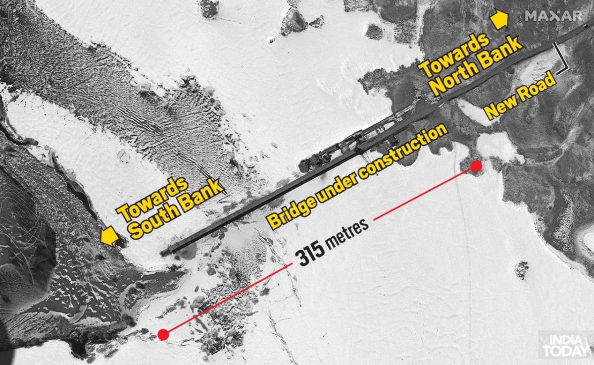
An analysis of the available imagery further suggests that the under-construction bridge is approximately 315 metres long. It connects the southern end of the lake to a newly built road in the north. Deployment of heavy machinery, as well as the presence of a possible supporting construction site in the north, can also be seen in the satellite pictures.
The government of India earlier said that it has been closely monitoring the activities. “This bridge is being constructed in areas that have been under illegal occupation by China for around 60 years now. As you are well aware, India has never accepted such illegal occupation," Arindam Bagchi, MEA spokesman said, earlier this month.
ALSO READ | China's bid to change status quo in Ladakh 'provocative': MoD in year-end review
While the entire Pangong lake is in a semi-frozen state at this time, areas near the construction site seem to have accumulated more solid ice than the western side of the lake.